- Home
- Services
ISO 9001-2015
ISO 9001-2015
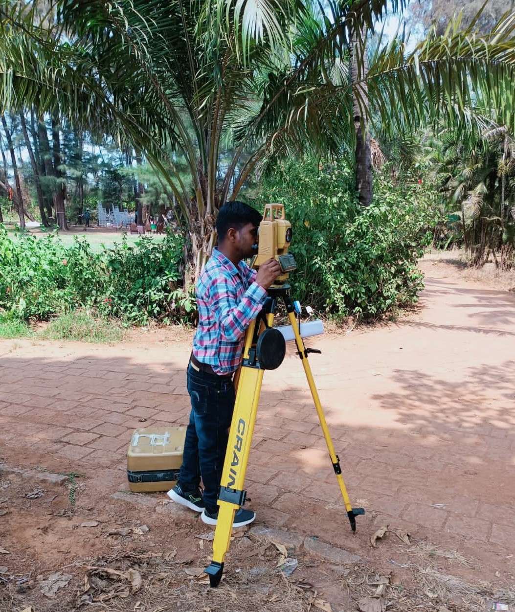
Service Provider of a wide range of services which include Topographical Survey Services, Flyover Survey Services, Route Survey Services and HT Line Survey Services..
Providing you the best range of Land Survey Services, GIS Survey Analysis and RTK SURVEY with effective & timely delivery..
Prominent & Leading Service Provider from New Delhi, we offer DGPS control points fixing, DGPS Survey, Soil Investigation, Contour Survey Services, River /Canal / Drain Survey Services and Drone Survey.
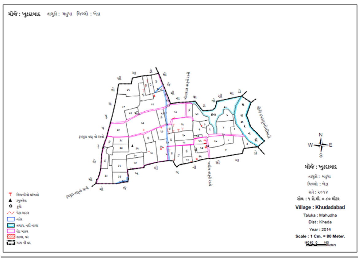
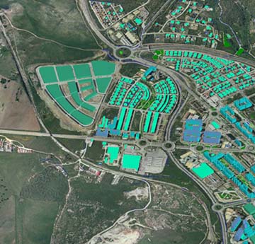
We strive to provide all-inclusive geographical information which act as a great source of information and empower areas like Data Conversion, Land Information Systems, Natural Resources Management, Urban Planning & Geographical Information Systems Applications. Our cutting edge technology and exceptional GIS solutions enables us to give a technological push to various development projects.

We believing that designing is the key to transform any space into functional environment. Every space starts with a new thinking and solutions. We are here to providing our precise services in the field of architecture and interiors
Providing you the best range of Land Survey Services, GIS Survey Analysis and RTK SURVEY with effective & timely delivery..

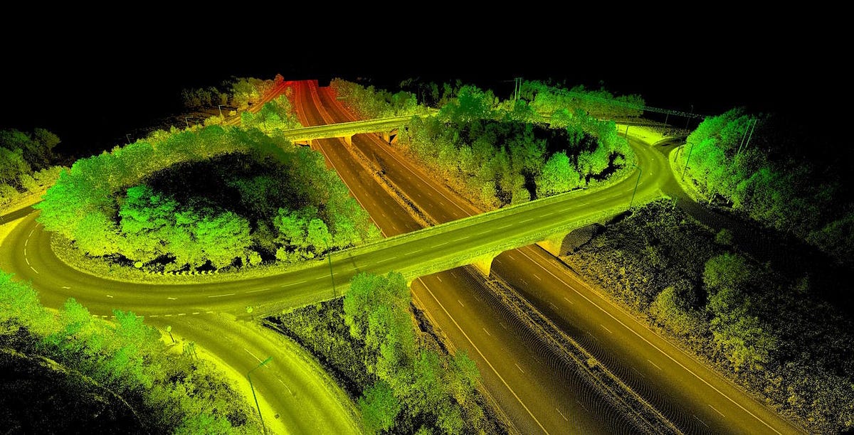
We specialize in advanced LiDAR survey solutions, delivering precise and reliable data for a wide range of industries. Our state-of-the-art technology and experienced team ensure accurate mapping, terrain analysis, and 3D modeling to support projects in construction, agriculture, environmental management, and more. Whether it's aerial, terrestrial, or mobile LiDAR, we provide customized services to meet your unique needs."
We offer professional Ground Penetrating Radar (GPR) survey services to provide accurate subsurface insights for your projects. Our cutting-edge GPR brtechnology enables precise detection and mapping of underground utilities, structures, and anomalies, supporting applications in construction, archaeology, environmental studies, and more. With a commitment to reliability and efficiency, we deliver tailored solutions to meet your specific needs."
INTECH ENGINEERS was established in 2004 with a view to provide professional services with latest technology and precise work in the field of Land Surveying and GIS Mapping.
Copyright © 2025 INTECH ENGINEERS. Designed & Developed by ![]() INTECH ENGINEERS
INTECH ENGINEERS